A historic Woodbridge landmark lost... and found again?
No longer there? Well, in a way. But what is time, when memory persists?
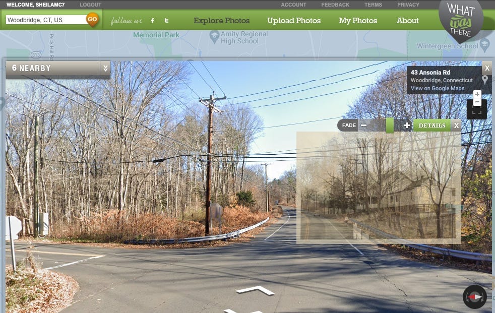
It turns out WhatWasThere.com, an online platform that allowed users to upload and explore historical photos mapped to their geographic locations, was indefinitely shut down in December 2023. That's unfortunate — although not unforeseeable, as no one can expect digital tools to be available for eternity. As ancient Greek philosophy reminds us “There is nothing permanent except change.”
Below is a screen capture image of the link I was pursuing when I stumbled upon the sad 404 message that alerted me to the demise of the WhatWasThere platform (I'm glad I save these things — and publish them here on TownHistory.org so I can find them again, too):
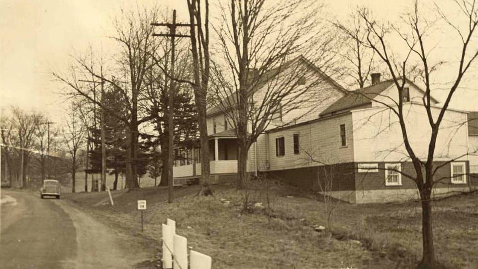
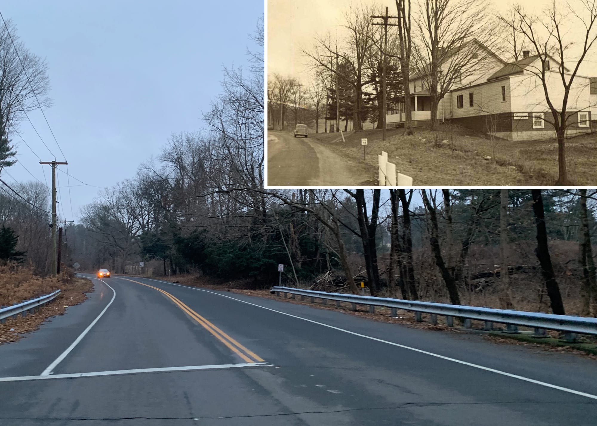
So let's make the best of this situation by some act of reinvention today. The original image, above, is a photograph taken between 1935 and 1942 for a Works Project Administration (WPA) Architectural Survey of historic buildings. It is included in the collection of the Connecticut State Library and is entitled "Woodbridge Historic Building 023." While at the time the photo was taken no street address was recorded — and indeed, many roads in Woodbridge did not have names, or had names that were later changed — we can locate this house by consulting a few other resources.
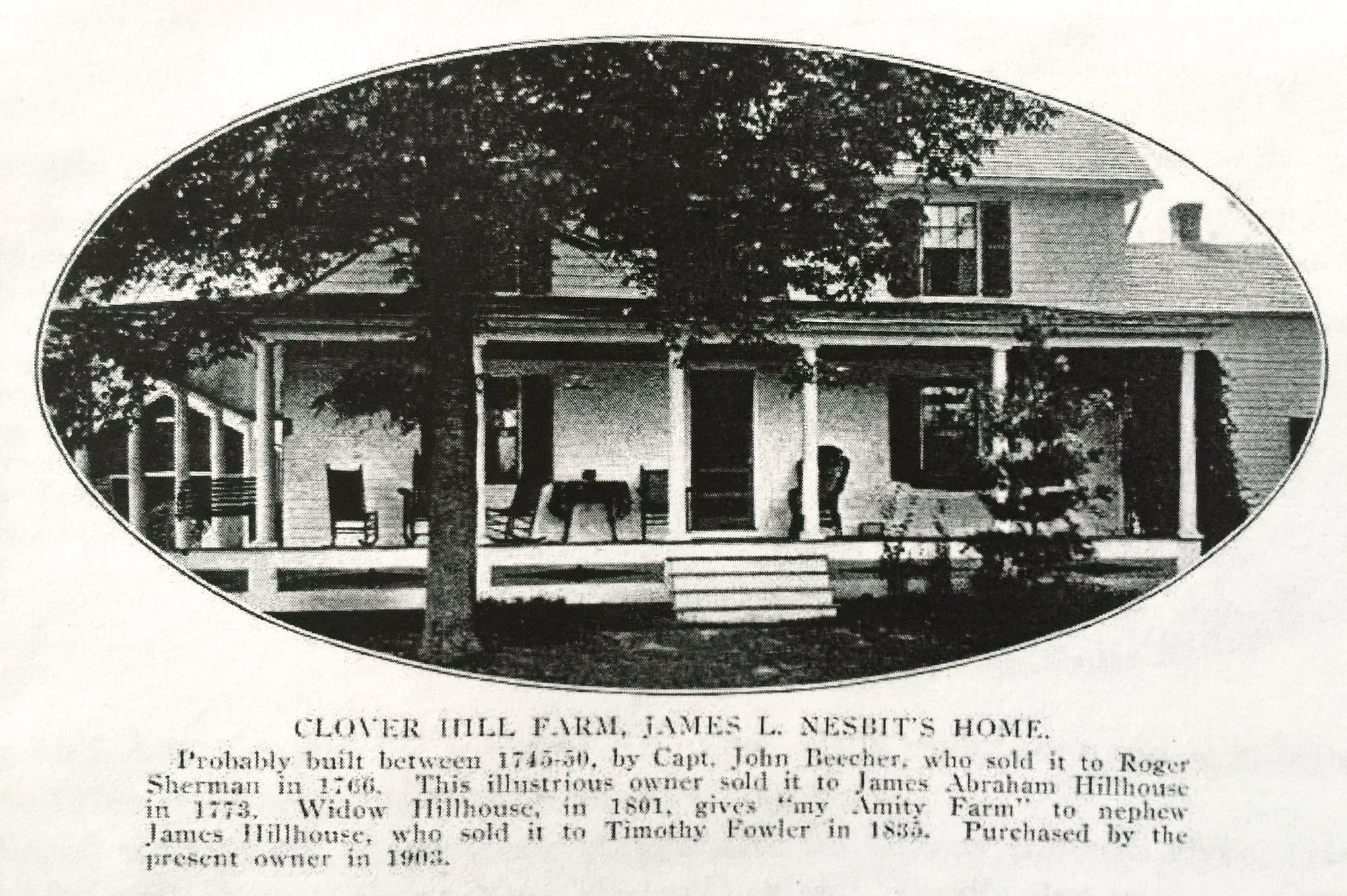
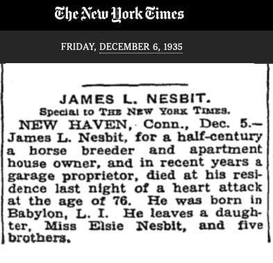
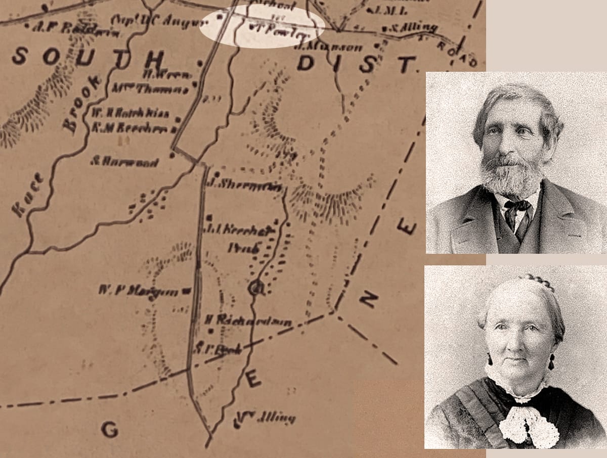
Described as 'the James L. Nesbit Home,' this is the same house featured on page four of the book Woodbridge Hills, published in 1911 by the Woodbridge Civic Association. James L. Nesbit (1859-1935) was born in New York and according to his obituary in the New York Times had been "for half a century a horse breeder” when he died in his home in Woodbridge in 1935.
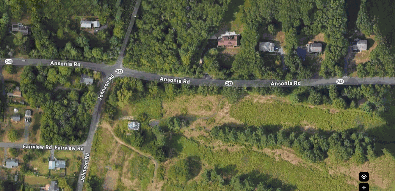
A prior owner of this home, according to the caption under the photo of the house in the 1911 publication, was Timothy Fowler III (1814-1888) and his wife Mary Eliza Stevens (1818-1885). The location of their home is marked on the 1868 Beers map of Woodbridge just east of a waterway that crosses Ansonia Road near the corner of Johnson Road (see highlighted area, marked T. Fowler).
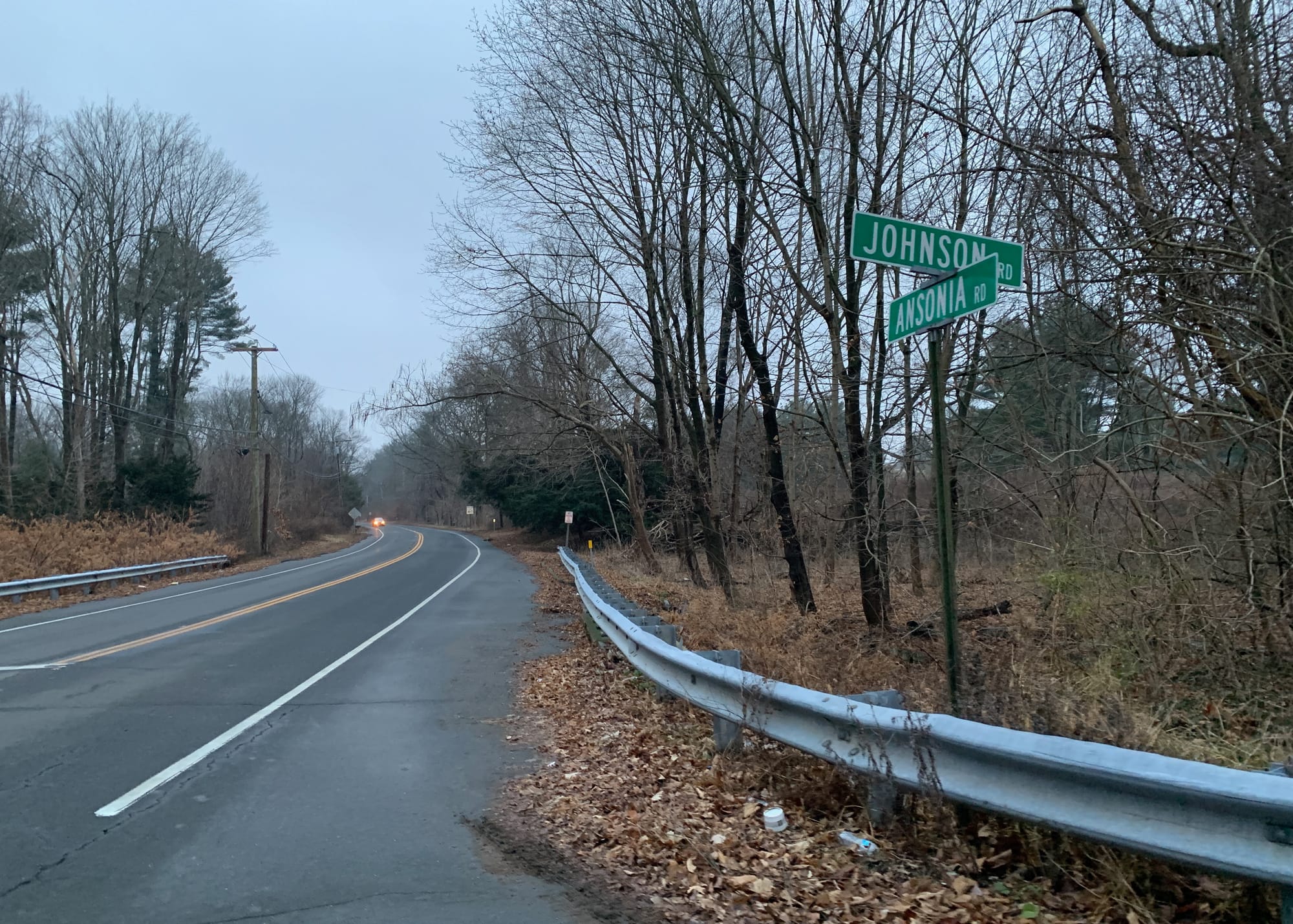
So now we can use these historic resources to locate approximately where the house stood on the property owned by the Town of Woodbridge since 2009. Here are some satellite views of this same corner of Johnson and Ansonia roads — can you picture the Fowlers' house approximately where the 'Ansonia' text appears in the first few frames?
Here's what the view looks like these days at street level (photographed on New Year's Eve back in 2021):
And below, with the WPA photo inset – are the evergreen trees below the inset photo offshoots of the same ones that originally framed the front walkway to the house? Perhaps only Timothy and Mary could tell us for sure.
Dear readers: Do you have memories of this house and the surrounding area? I would be delighted to hear from you, if you'd like to share any details you may be able to recall. You can contact me by email at: sheila.mccreven@gmail.com