Undeveloped land in Woodbridge: A legacy of conservation, community, and vision for the future
The town of Woodbridge holds a remarkable legacy in its undeveloped land and publicly owned property. The history of these acquisitions tells a story of thoughtful stewardship, civic vision, and historical preservation. These properties constitute a vital part of the town’s heritage. The mosaic of open spaces, historical landmarks, and community-focused lands they comprise embodies a commitment by townspeople — both past and present — to ecological conservation, recreational opportunities, and cultural preservation that allows us to maintain a deep connection to Woodbridge's past. From the efforts of early land donors to strategic modern planning, the story of Woodbridge’s land management reflects thoughtful stewardship and a forward-looking vision for sustainability and community well-being. Let's look at some of this history...
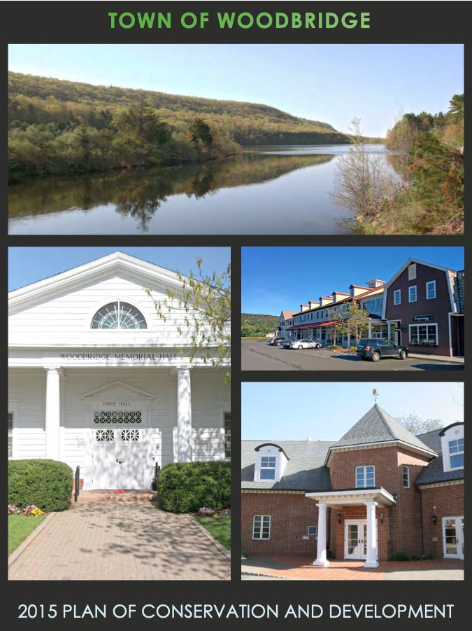
Two important sources of information are the 1982 Survey of Publicly Owned Property and the Town's 2015-2025 Plan of Conservation and Development. We've looked at both documents in some past essays here on TownHistory.org (Some history of publicly owned property in Woodbridge and Planning for capital improvements and longterm projects), but today, let's summarize what each document has to say on the topic of undeveloped land in Woodbridge.
The Survey, published in 1982 by the Commission of the Use of Publicly Owned Property, does a remarkable job documenting Woodbridge’s dedication to land conservation that is evident in some of the key acquisition it recounts. These include properties such as the Acorn Hill parcel, known as the former Haddad-Tinari property, purchased in 1968. Originally acquired for landfill purposes, this 60-acre property was later protected under an open space grant in 1974, ensuring its future use for conservation and recreation.
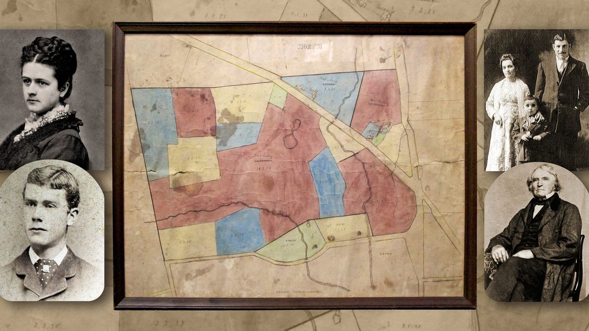
Today the site of the Acorn Hill ballfields and the Town's Transfer Station, this property belonged at one time to the Haddad family — according to the Historic Woodbridge entry for their home nearby on Acorn Hill Road:
...Known as the Haddad Farm for its association of more than 70 years with a family of Syrian ancestry, this large property originally belonged to W. J. Peck. Yanius Haddad and his wife Yuride Ayoub, born in Syria, came here from Ansonia and bought the farm in 1921. At that time, the property consisted of three parcels, totaling 220 acres, which extended across the road and into Seymour.
...They were assisted by their son, John H. Haddad (1906-1968), who was born in Ansonia and married Estelle Drewelus (b. 1908) in 1931. The Haddads engaged in mixed farming, raising sheep, dairy cows, and vegetables. The latter were sold in Ansonia and transported by wagon across the old stone road still visible under nearby Peat Swamp Reservoir. There also was a game farm across the street.
By 1960 the homestead with this house was quitclaimed to Lillian Tinari (later Mennillo), the present owner. The rest of the property was eventually sold off or divided up among relatives, including Charles Yanius Haddad, who received the 4-acre piece next to the homestead in 1977.
Similarly, the expansive FitzGerald parcel, encompassing 133 acres in the center of town, was purchased in 1973 at a Special Town Meeting, guided by the foresight of the people of Woodbridge who wanted to ensure the public's use of the open farmland, woodlands, and trails located here. A previous essay details the history of this parcel. Today, the FitzGerald property serves as one of the centerpieces of Woodbridge, home to the Dog Park, Chesnut Grove, Community Gardens, and the Recreation Department's Fitness Trails, as well as fields leased for agricultural activities. All told, this parcel embodies many aspects of the town’s vision of continued environmental stewardship.
Likewise, many of Woodbridge’s other Town-owned properties have been repurposed to foster community engagement and recreation. The Center Field and Town Hall Tract, acquired in the early 20th century, has been a hub for public life, housing municipal offices, recreational facilities, and open spaces for community events. This land was previously owned by Chester C. Hitchcock (1889-1962) who served as First Selectman of Woodbridge from 1935 to 1947 (and later served as our state representative from 1946-1952).
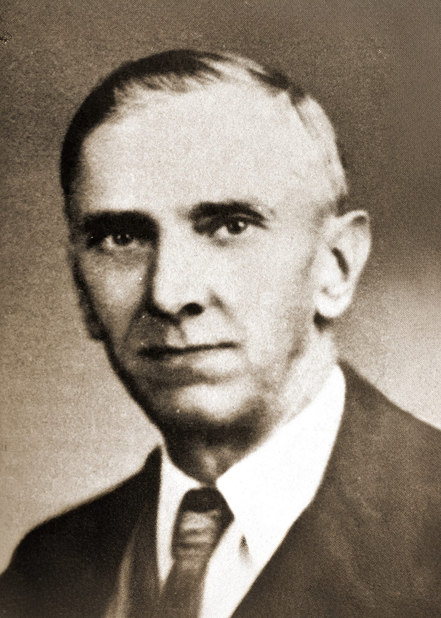
Former Woodbridge First Selectman Chester C. Hitchcock, who once owned the parcel where the Center Ball Fields, Tennis Courts, Public Works facility and Town Hall now stand.
The Rice Property on Center Road is another example of how the town blends historical and recreational purposes. Acquired in 1967, the property once included a charming house and pond — both of which have nearly vanished into the woods — this parcel illustrates the evolving use, and lasting value, of publicly held undeveloped land. The colorful history of this property and its former owner, Lillian Rice, is also detailed in a previous essay.
Woodbridge’s undeveloped properties also serve as tangible links to the town’s past. As recounted in the CUPOP Survey, the former Thomas Darling property, situated amidst the G. Halstead Bishop Estate parcel, was acquired in stages during the 20th century, and includes historic buildings such as the house itself, which now functions as a museum, as well as several associated barns. This property not only preserves architectural history but also honors the contributions of early residents to the town’s cultural landscape. In another previous essay, the significance of several Town-owned parcels for agricultural use, including the Bishop Estate fields, was examined.
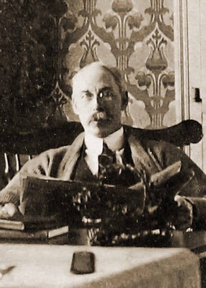
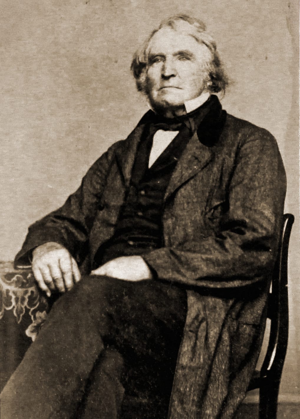
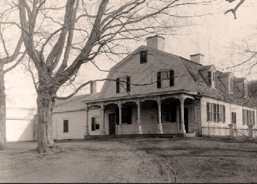
G.Halstead Bishop, Thomas Darling III, and the Town-owned Thomas Darling House on Litchfield Turnpike in Woodbridge.
As we can see from these examples of property acquisition described in the CUPOP Survey, Woodbridge’s public lands can generally be categorized into three types: undeveloped land, protected open space, and land reserved for future municipal use. Undeveloped land refers to properties that remain in their natural state, often with woodlands, fields, or wetlands, and may not yet have a designated purpose. Protected open space, such as the Acorn Hill Landfill or the Thomas Darling property, is land formally preserved under legal restrictions for conservation and recreation. This ensures its ecological value and public access for activities like hiking and nature appreciation. Land reserved for future municipal use includes properties such as portions of the Fitzgerald Tract, which have been left undeveloped to accommodate potential future needs, like additional recreational facilities or public buildings. These distinctions guide how each parcel contributes to the community while allowing flexibility in planning.
Woodbridge’s current 10-year Plan of Conservation and Development (POCD), which continues in effect through Spring of 2025, is another document that helps provide an overview of land use in town. It also emphasized the significance of the undeveloped land categorized as open space in shaping the town’s character, providing recreational opportunities, and conserving natural resources.
Altogether, in 2015 Woodbridge contained 4,566 acres of open space, representing 37% of the town’s total land area. Chapter 6 of the plan categorized open space into varying levels of protection, from fully protected lands to unprotected open lands, and highlights the need for targeted programs to maximize preservation efforts. These include:
• Protected Open Space: Managed by the town, state, or conservation organizations, these lands are permanently preserved for ecological, recreational, or agricultural purposes. This category also includes RWA Protected Lands, which are watershed lands with restrictions based on their classification (Class I and II being most protected).
• Other Open Lands: Include municipally managed spaces, agricultural lands under PA 490 tax incentives, RWA Managed parcels (which are subject to less stringent protections than Class I and Class II lands), and unprotected privately owned lands.

With the above definitions, the POCD written in 2015 provided a comprehensive view of land distribution within the town. Of the town's total open space, 67% was classified as “Protected Open Space” ensuring long-term conservation and limited development potential. This category included:
• Woodbridge Land Trust (WLT) and Woodbridge Park Association (WPA) Ownership: These organizations collectively own 342 acres, accounting for 7% of open space and 3% of the town's total land area.
• Municipally Protected Lands: The town safeguards 728 acres, making up 16% of open space and 6% of the town's total area.
• State Protected Lands: State-owned properties include 102 acres, representing 2% of open space and 1% of the total area.
• Regional Water Authority (RWA) Protected Lands: RWA maintains the largest share of protected open space, with 1,881 acres (41% of open space and 15% of town area). This is further divided into Class I (809 acres) and Class II (1,072 acres) lands, which are subject to stringent conservation regulations.
And the remaining 33% of open space was categorized as “Other Open Land” which included:
• RWA Managed Lands: These comprise 31 acres (1% of open space and less than 1% of the town area), which are subject to less stringent protections than Class I and Class II lands.
• Municipally Managed Lands: The town manages an additional 549 acres (12% of open space and 5% of the town's area) that are not permanently protected.
• Lands under Public Act 490 (PA 490): Designated as forest, farmland, or open space, these lands benefit from tax incentives and cover 787 acres (17% of open space and 6% of the town's area).
• Unprotected Lands: Privately owned lands without development restrictions total 146 acres, comprising 3% of open space and 1% of the town's area.
In addition to the town’s efforts to preserve open space, two dedicated land trust organizations play vital roles in safeguarding Woodbridge’s natural and recreational treasures: the Woodbridge Park Association (WPA) and the Woodbridge Land Trust. Let's take a look at some of their important contributions.
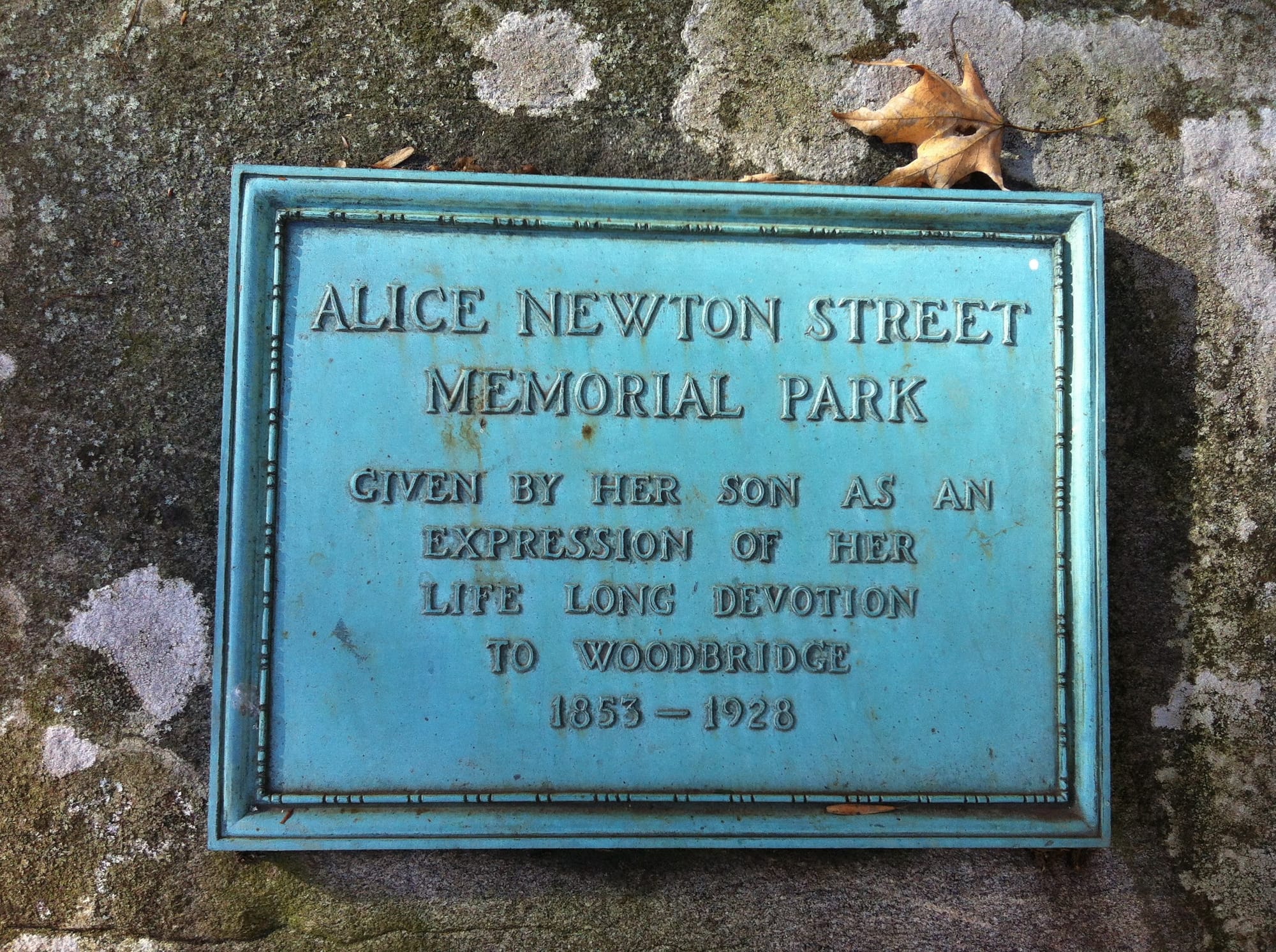
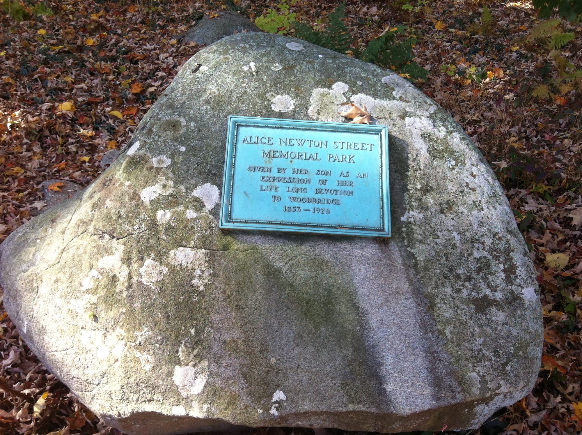
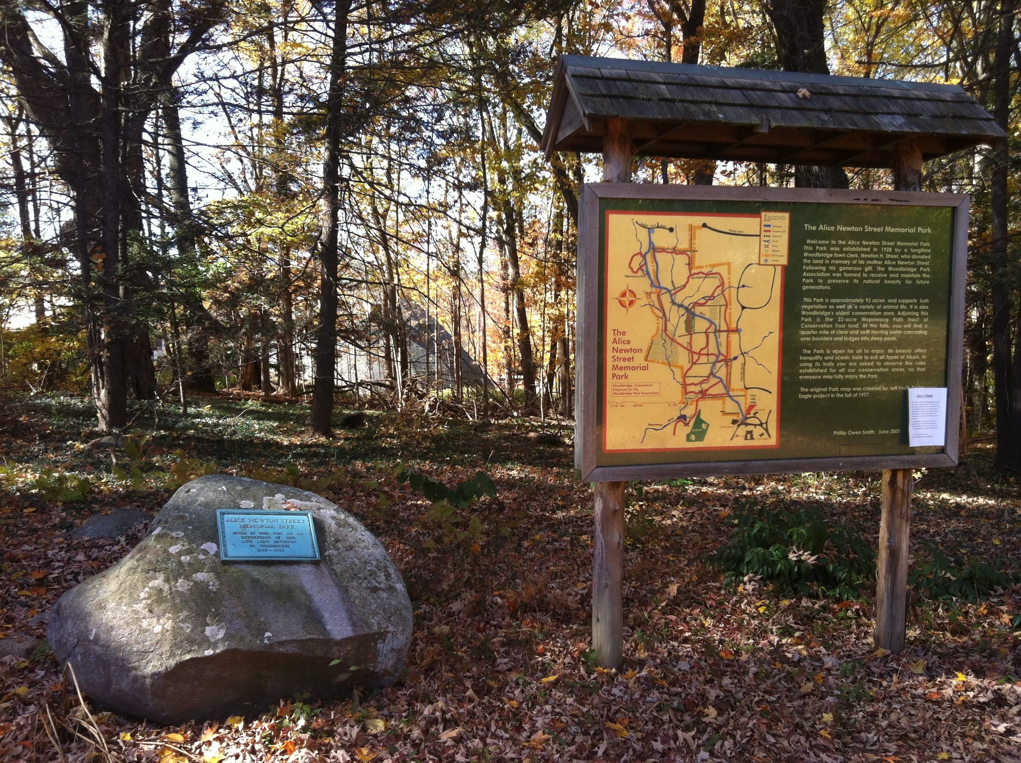
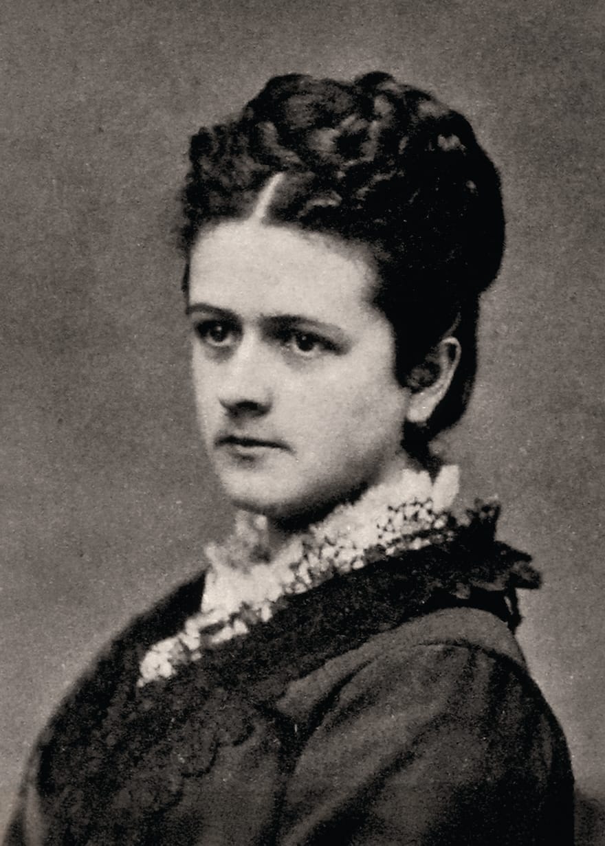
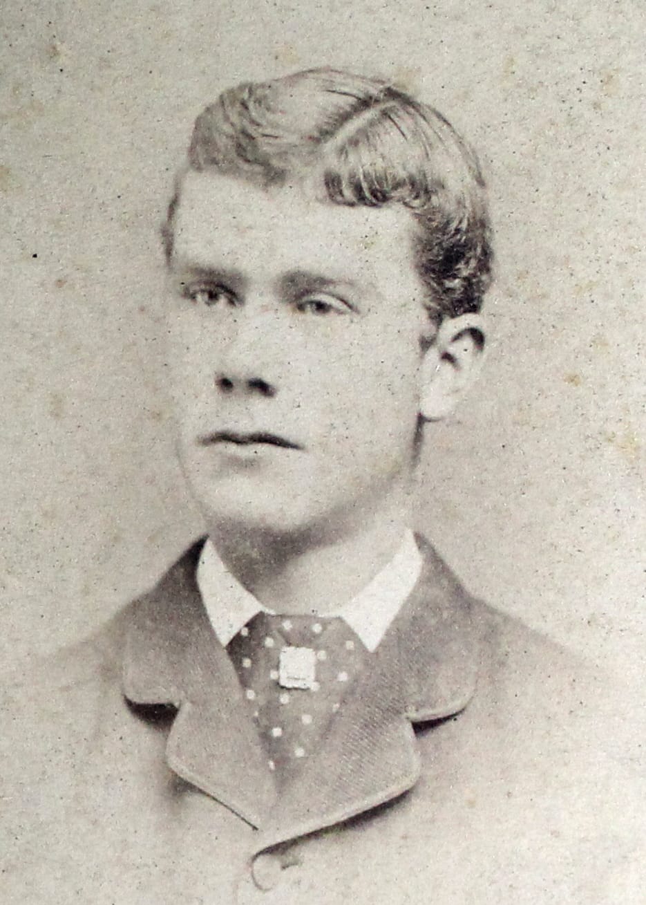
Alice May Newton Street and her son Newton Herbert Street: his donation of land to establish a park in her name — given “as and expression of her life long devotion to Woodbridge” — exemplifies the commitment of past residents to safeguarding habitats and promoting public access to nature.
The Woodbridge Park Association, founded in 1928, is Connecticut’s third-oldest land trust. Its mission is rooted in ecological preservation, historical protection, and fostering public access to nature. Key highlights include the Alice Newton Street Memorial Park, established with an 82-acre donation from Newton Herbert Street (1895-1979) in memory of his mother, Alice May Newton Street (1953-1928). The Historic Woodbridge book notes that Alice had been born while her family lived in an old family house on Newton Road nearby the future park:
A daughter of Samuel Peck Newton and Harriet Elizabeth Beecher, she married Samuel Hotchkiss Street. In 1928 the couple's son, Newton Herbert Street, donated 82 acres in memory of his mother to found the Alice Newton Street Memorial Park. Encompassing over 90 acres in the center of town today, the trails traverse the hills, streams, woods, wetlands and picturesque meadow that was former farmland. The park is owned and maintained by the Woodbridge Park Association.
Over the years, WPA has expanded its holdings to over 100 acres in this park alone. According to the WPA website:
Since the founding gift from the Street family in 1928, an additional 32.5 acres have been donated to the WPA. Twenty-five and a half of those acres lie adjacent to the Alice Newton Street Memorial Park, increasing its size to over 100 acres. The remaining 7 acres of donated land are located on the east side of Newton Road and form the Newton Road Park. Please check out our ‘Maps‘ link for more information on locations and hiking, as well as our ‘Use of Parks‘ safety guidelines.
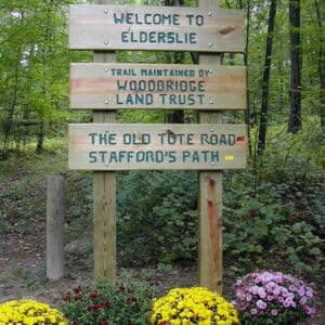
The Land Trust's sign at the FitzGerald Tract describes its Chesnut Orchard project, while another sign marks the entry to the Elderslie Preserve.
The Woodbridge Land Trust complements WPA’s efforts by owning and managing over 160 acres in town and holding conservation easements on approximately 600 more. This vast network of protected spaces ensures that woodlands, wetlands, and trails remain undisturbed and available for public enjoyment. According to its website, the Trust maintains 20 miles of hiking trails and 25 trailheads, making it an essential steward of Woodbridge’s outdoor spaces. Its cooperative approach with community groups enhances the use and management of public lands. A previous essay looked back on the 20-year anniversary of the Town's purchase of the Elderslie Preserve in 2002, where the Woodbridge Land Trust holds a conservation easement on 198 acres of land.
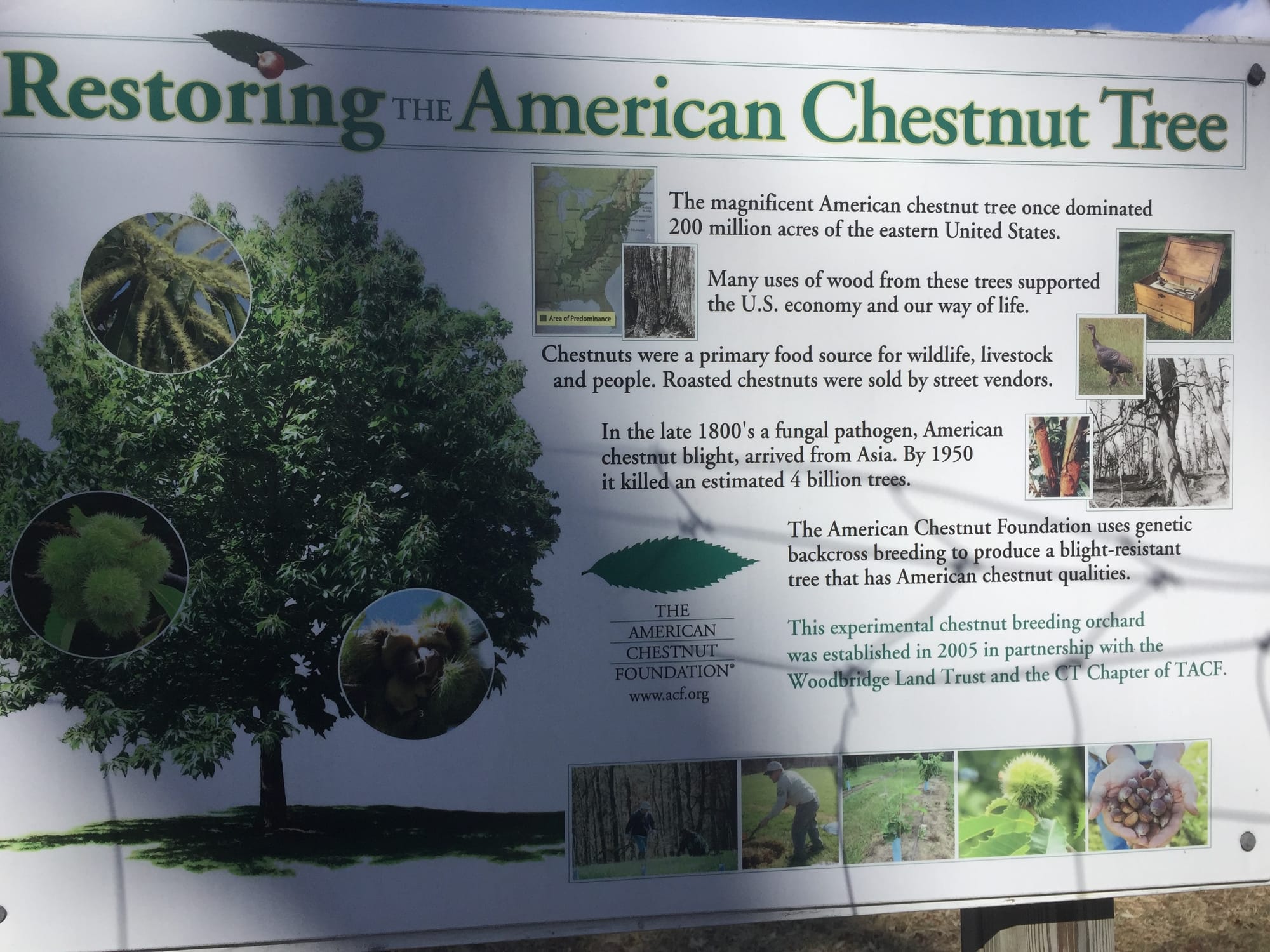
The Trust is also at the forefront of conservation innovation, hosting one of only seven American Chestnut Research Orchards in Connecticut. Located at the Fitzgerald Walking Trails, this orchard is part of a broader effort with the American Chestnut Foundation to develop disease-resistant trees and begin to repopulate the species.
Together, the Woodbridge Park Association and the Woodbridge Land Trust are vital partners in the Town’s conservation efforts. Their complementary missions ensure that Woodbridge’s natural beauty, biodiversity, and recreational opportunities are preserved for future generations. From fostering wildlife habitats to nurturing innovative research, these organizations exemplify the town’s enduring commitment to open space and environmental stewardship.
A continuing commitment
The history of Woodbridge’s undeveloped land is one of continuity and vision. From the Northwest Cemetery, whose origins predate the town’s incorporation in 1784, to the recent acquisition of Cloverhill, the former Country Club of Woodbridge property, these public lands stand as testament to the foresight of previous town leaders and the people of our community who have voted at various town meetings throughout the years to help ensure that Woodbridge remains a community where open spaces, historical landmarks, and public amenities are preserved for future generations.
As the people of Woodbridge look ahead — to the development of the next 10-year plan and beyond — these properties will no doubt continue to shape its identity. The upcoming process to create the next POCD for Woodbridge could emphasize the historical and ecological value of open spaces while aiming to increase community involvement in addressing future challenges. By including historical narratives, the plan could highlight the cultural significance of open spaces. Expanding partnerships with land trusts and engaging residents through stewardship programs would serve to strengthen community connections to these lands.
Importantly, the next POCD could also recognize the ecosystem services provided by open spaces, like carbon sequestration, water purification and biodiversity conservation, presenting these as tangible benefits for future grant applications and funding justifications. A proactive approach to land acquisition, prioritizing parcels based on ecological, historical, and recreational significance, is essential, along with efforts to create connected greenways and trails. Framing open space preservation as a climate resilience strategy, with goals for flood mitigation and habitat protection, and developing stewardship plans for municipally owned lands could help ensure sustainable management while maintaining flexibility for future needs.
By aligning preservation efforts with historical insights and expanding on ecological and community benefits, Woodbridge can strengthen its municipal planning to meet the needs of future residents by building on the foundation set by previous generations. With careful updates, the next ten-year plan holds the promise of not only ensuring the protection of Woodbridge open spaces but also reinforcing their value as integral to the town’s identity and resilience. After all, these lands provide not only ecological and recreational benefits but also allow us to embrace a sense of place and continuity that binds generations of Woodbridge residents — current and future — to a shared heritage.